The Grampians National Park (wikipedia) (also Gariwerd), commonly referred to as The Grampians, is a national park located in the Grampians region of Victoria, Australia. The 167,219-hectare (413,210-acre) national park is situated between Stawell and Horsham on the Western Highway and Dunkeld on the Glenelg Highway, 260 kilometres (160 mi) west of Melbourne and 460 kilometres (290 mi) east of Adelaide. Proclaimed as a national park on 1 July 1984 (1984-07-01), the park was listed on the Australian National Heritage List on 15 December 2006 for its outstanding natural beauty and being one of the richest indigenous rock art sites in south-eastern Australia. The Grampians feature a striking series of sandstone mountain ranges.
Etymology
Named Gariwerd by one of the local Australian Aboriginal languages, either the Jardwadjali or Djab Wurrung language, the ranges were given their European name in 1836 by Surveyor General of New South Wales Sir Thomas Mitchell after the Grampian Mountains in his native Scotland. After a two-year consultation process, the park was renamed Grampians (Gariwerd) National Park in 1991, however this controversial formality was reversed after a change of state government in 1992. The Geographic Place Names Act, 1998 (Vic) reinstated dual naming for geographical features, and this has been subsequently adopted in the Park based on Jardwadjali and Djab Wurrung names for rock art sites and landscape features with the National Heritage List referring to Grampians National Park (Gariwerd).
This area is a distinct physiographic section of the larger Western Victorian Highlands province, which in turn is part of the larger East Australian Cordillera physiographic division.
Geography
The general form that the ranges take is, from the west, a series of low-angled sandstone ridges running roughly north-south. The eastern sides of the ridges, where the sedimentary layers have faulted, are steep and spectacular, beyond the vertical in places – notably at Hollow Mountain near Dadswell’s Bridge at the northern end of the ranges. The most popular walking area for day trippers is the Wonderland area near Halls Gap. In summer the ranges can get very hot and dry. Winter and spring are the best times for walking. The Wonderland area is also host to “The Grand Canyon” on the “Wonderland Loop” on one of the tracks to the “Pinnacle”.
In spring the Grampians wildflowers are a major attraction. The area is a noted rock climbing destination, and it is popular with campers and bushwalkers for its many spectacular views and unspoilt nature.
Mount William is known within the gliding community as the epicentre of the ‘Grampians Wave’, a weather phenomenon enabling glider pilots to reach extreme altitudes above 28,000 ft (8,500 m). This predominantly occurs during the months of May, June, September and October when strong westerly winds flow at right angles to the ridge, and produce a large-scale standing wave (Mountain Lee Wave).
Geology
The rock material that composes the high peaks is sandstone which was laid down from rivers during the Devonian period 380 million years ago. This sediment slowly accumulated to a depth of 7 km; this was later raised and tilted for its present form. Forty million years ago the Southern Ocean reached the base of the northern and western base of the mountain range, the deposition from the range forming the sea floor which is now Little Desert National Park.
The highest peak is Mount William at 1167 metres. Numerous waterfalls are found in the park and are easily accessible via a well-developed road network.
Cultural heritage
To the Jardwadjali and Djab wurrung peoples, Gariwerd was central to the dreaming of the creator, Bunjil, and buledji Brambimbula, the two brothers Bram, who were responsible for the creation and naming of many landscape features in western Victoria.
Grampians National Park (Gariwerd) is one of the richest Indigenous rock art sites in south-eastern Australia and was listed on the National Heritage for its natural beauty and its past and continuing aboriginal cultural associations. Motifs painted in numerous caves include depictions of humans, human hands, animal tracks and birds. Notable rock art sites include: Billimina (Glenisla shelter)
The rock art was created by Jardwadjali and Djab Wurrung peoples, and while Aboriginal communities continue to pass on knowledge and cultural traditions, much indigenous knowledge has also been lost since European settlement of the area from 1840. The significance of the right hand prints at Gulgurn Manja is now unknown.
Hamilton (wikipedia) is a city in western Victoria, Australia, at the intersection of the Glenelg Highway (from Ballarat to Mount Gambier) and the Henty Highway (from Portland to Horsham). The Hamilton Highway connects it to Geelong.
Hamilton is in the federal Division of Wannon, and is in the Southern Grampians local government area.
Hamilton used to claim to be the “Wool Capital of the World”, based on its strong historical links to sheep grazing which continue today. These days, the town uses the “Greater Hamilton: one place, many possibilities” tagline, recognising the good schools, highly skilled workforce and rich natural beauty of the region.
Early history
Hamilton was built near the border of three traditional indigenous tribal territories: the Gunditjmara land that stretches south to the coast, the Tjapwurong land to the north east and the Bunganditj territory to the west. People who lived in these areas tended to be settled rather than nomadic. The region is fertile and well-watered, leading to an abundance of wildlife, and no need to travel far for food. Physical remains such as the weirs and fish traps found in Lake Condah to the south of Hamilton, as well as accounts of early white settlers support local indigenous oral histories of well-established settlements in the area.
White settlement and conflict.,
On 12 September 1836, the explorer, Major Thomas Mitchell was the first European to travel through the area where Hamilton later developed. His reports of the fertility and abundance of ‘Australia Felix’ (as he called this region of Western Victoria) encouraged pastoralists to move to the area and establish large sheep runs. By 1839 there were a number of settlers in the area including the Wedge family whose property ‘The Grange’ was located within the present town site.
Conflict between the pastoralists and the indigenous population soon arose. The local people resisted encroachment on their traditional tribal lands. They stole and killed sheep for food and out of retaliation for the settlers’ use of their hunting territory as grazing land. A number of Aborigines in the Western district were murdered in this period in the resulting conflicts.
When Governor La Trobe visited The Grange in 1841 he noted the extent of interracial violence and appointed Acheson French as police magistrate to the area. A constable and a detachment of mounted police, to be based at The Grange, were also appointed and convicts from Portland erected a hut for the magistrate and barracks for the troopers on the site of the present courthouse and police station on Martin and Thompson Streets.
Another result of the conflict was the establishment of an Aboriginal reserve, intended for the protection of the indigenous people. This further angered the pastoralists who regarded the reserve and its administration as hostile to their interests. Violence and brutality appear to have continued unchecked until Governor La Trobe ordered the Portland Commissioner, all his border police and a contingent of ‘native police’ to the Grange in September 1842. This, along with the effects of dislocation, European diseases, and killings marked the end of most of the indigenous resistance in the area.
Birth of the town
The proximity of The Grange to other properties and to important tracks between Portland and New South Wales led to the gradual emergence of a small town. This included an inn, blacksmith, a small store and some shanties and businesses nearby. The site was a small social centre for surrounding pastoral properties, with horse races being held along the Grange Burn flat. A Post Office opened on 1 July 1844 (Hamilton from 1 January 1854). The desire for a school prompted a town survey that commenced in 1849. The township of Hamilton was formally declared in 1851. The town was named in the following way as quoted by the book, “Dundas Shire Centenary 1863-1963”, page 58. Quote: “In 1840, owing to police difficulties in controlling public houses on, or not on the imaginary boundary line, Henry Wade was sent from Sydney on a special mission to mark out the boundary. He completed the survey as far as Serviceton by the spring of 1847, and was then appointed District Surveyor and in 1850, laid out a township for the Grange, which he named Hamilton. It was then the prerogative of the surveyor to christen his lay-out. Wade and his family had made close friends of the Hamiltons and Gibsons of Bringalbert, there being intermarriages later.” Unquote.
29th December, Monday
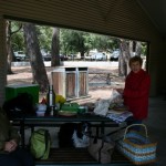
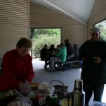
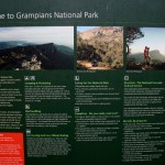
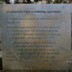
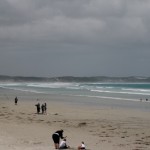
This morning we didn’t rush to leave seeing as we all had such a late night. We had breakfast and Jenny and Doug being Jenny and Doug started packing up food, picnic baskets, coffee etc. (This house is a foodie heaven). We had to go in 2 cars as there are 6 of us plus Hugo. On the way to the Grampians it’s through farmland, mainly sheep and I have never seen so many sheep in my life. I think that Doug told me that this area is the sheep capital of Australia and when you see it you can believe it. The fields have all been harvested and I think that it is mainly grown for feed stock. The fields are the colour of gold and the contrast of the gold against the mountains is quite beautiful. Our first stop was in the Grampian National Park at the Cultural centre to get info on the area and also to get the gist of cultural significance in this area. You will need to see the blurb I downloaded above to see what the Grampians are about. Our next stop was for a picnic lunch (prepared and cooked by Jenny and Doug) at Halls Gap which is a small town in the Grampians, touristy but not over the top. It boasts a few nic nac shops, bakery, ice creamery etc. It’s quite charming and there are quite a few small accomodation places which at this time of the year all seemed to be booked out. It was raining most of the morning and a bit chills but that didn’t stop us venturing out and enjoying the sites and the weather did clear later in the day to give us some sunshine. Next stop was Baroka lookout which overlooks the lake. The lookout is spectacular and once again no photography that I take could do it justice, it blows your breath away with it’s beauty. After that, Reids lookout which I think is the highest point of the Grampians as the Fire Station lookout is located there as is the Helipad for the area. Mc Kenzies falls was our next stop and we had a bit of a walk to the lookout. There were 2 falls there, the other was called “Broken Falls”. There is a beautiful walk through the bush which Caroline and I did. The Black Saturday bushfire that happened in Feb 2009 is still pretty evident here in the Grampians. The undergrowth has generated itself amazingly. The trunks of the trees are still black but they all have new growth. You can still smell a faint whiff of the burnt tree trunks in places. It astounds me how nature fights back. The wild flowers are out and in the aftermath of such devastation the place is growing back amazingly. We can only hope that all the little creatures that were lost have come back as well as the bush has. From there was just a small toilet stop at a place called “Zumsteins”, there was a little stream running through there as well as a little burnt out (from the fire) residence. We took a different road back to Hamilton through Brimpaen and Cavendish. Back to home Jenny and Doug home base, more snacks (prepared by Jen) and another amazing meal. I am going to have to jog everyday when we get back to our caravan in Bendigo.
ramds
-
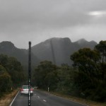
- The Grampians, that’s Beryls car in front of us
-

- Halls Gap
-
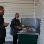
- Ralph and cook Doug
-
- Jenny, Beryl and Hugo
-
- Jenny and Caroline
-
- The Grampians
-
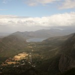
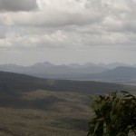
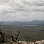
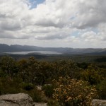
- Baroka lookout – The Grampians
-

- Baroka lookout – The Grampians
-

- Baroka lookout – The Grampians
-

- Re
-

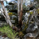
- Reids lookout – The Grampians
-

- Reids lookout – The Grampians
-

- Reids lookout – The Grampians
-
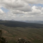
- Reids lookout – The Grampians
-
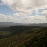
- Reids lookout – The Grampians
-
- Reids lookout – The Grampians
-
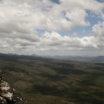
- Reids lookout – The Grampians
-

- Reids lookout – The Grampians
-
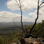
- Reids lookout – The Grampians
-
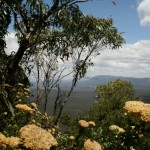
- Reids lookout – The Grampians
outout e
-

- Reids lookout – The Grampians
-
- Reids lookout – The Grampians
-

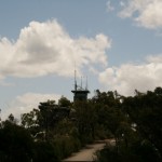
- Fire station and lookout
-

- Reids lookout – The Grampians
-
- Reids lookout – The Grampians
-
- Reids lookout – The Grampians
-
- Reids lookout – The Grampians
-

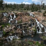
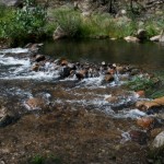
- Mc Kenzies falls
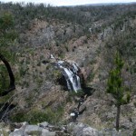
-
- Broken falls
-
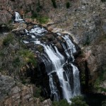
- Mc Kenzies falls
-
- Mc Kenzies falls
-
- Grampians
-
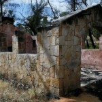
- Burnout hut – Zumsteins
-
- Zumsteins
-

- Zumsteins
30th December, Tuesday
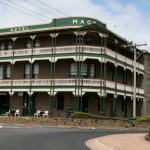
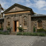
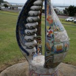
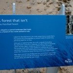
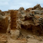
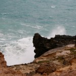
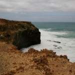
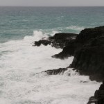
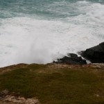
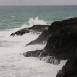
Today we were taken to Portland. The drive is about 100kms from Hamilton and is and old Port settlement – one of the oldest ports in Australia and was a convict settlement and was founded in 1800. Portland used to be a whaling town as well and there is still the old melting pot for the whale fat on display in the park. Portland is a natural deep port enabling large ships to come in. There is an aluminium smelter, bauxite transfer from the wharf to the smelter via enclosed conveyor belts, which is transported worldwide. The industry here was also wool export as I mentioned before about this region being the biggest sheep farming area in Australia. There are also huge grain silos which is exported as well. Mineral sands is another export as is wood chips and pine logs, so you can see that this port is very busy indeed. Next year there is a plan to bring in crew ships. We went to the Gordon hotel for lunch and then we went Bridgewater. There is a petrified forest on the cliffs but it’s not petrified wood as once believed, it’s rock and the formations are amazing. The coast line along here is beautiful, rugged and fierce. Standing on the cliffs and watching the waves pound against the rocks you can understand why there are so many ship wrecks along this coastline….. poor buggers wouldn’t stand a chance as this is a raging sea, beautiful but deadly. We stopped in a little town called Heywood on the way back for afternoon tea and then back to Hamilton with a quick stop to see Jennys beautiful church.
-
- Portland
-

- Portland
-
- Portland
-
- Portland
-

- Portland
-

- Beryl, Ralph, Jenny and Hugo
-
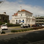
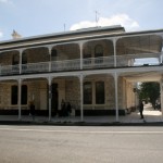
- Town Hall – Portland
-
- Portland
-
- Portland
-

- Portland
-
- Portland
-
- Portland
-
- Portland
-
- Petrified forrest
-

- Petrified forrest
-
- Portland
-

- Petrified forrest
-
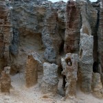
- Petrified forrest
-
- Portland
-
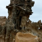
- Petrified forrest
-

- Portland
-

- Blowholes
-
- Blowholes
-
- Blowholes
-
- Blowholes
-

- Blowholes
-
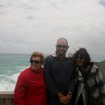
- Ralph, Jenny and Linda
-
- Portland
-
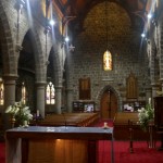
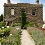
- Jennys church
-
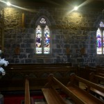
- Jennys church
-
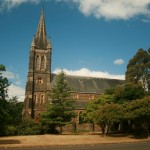
- Jennys church
-
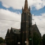
- Prespeterian church
-
- Jennys church
31st December, Wednesday (New Years eve)
Today we were taken to Penola which is about 120kms from Hamilton and takes us into South Australia. The town is renowned for the schools and churches where Mary Mc Killop taught. We had a picnic lunch in the park and then visited the Coonawarra wine district and stopped for a little taste or 2 and of course walked out with a few bottles of wine. We got back to Hamilton in the early afternoon, had a few drinks and got ready for dinner. We went to a lovely restaurant for New Years eve but us old farts were home by 10 and never did get to see the New Year in. We are leaving for Bendigo early in the morning so didn’t want a late night anyway.
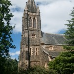
-
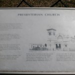
- Prespeterian church Penola
-
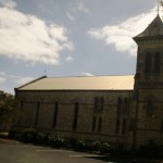
- Prespeterian church Penola
-
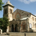
- Prespeterian church Penola
-
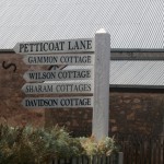
- Petticoat lane – Penola
-

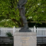
- The school – Mary Mc Killop
-
- The school – Mary Mc Killop
-
- The school – Mary Mc Killop
-

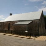
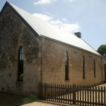
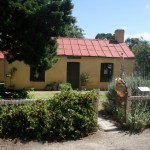
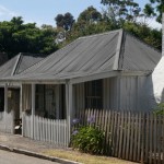
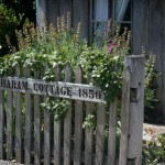
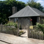
- Historic Penola
-
- Historic Penola
-

- Historic Penola
-

- Historic Penola
-
- Historic Penola
-
- Historic Penola
-
- Historic Penola
-
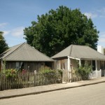
- Historic Penola
-

- Historic Penola
-

- Historic Penola
-

- Historic Penola
-

- Historic Penola
-
- Historic Penola
-
- Historic Penola
-

- Historic Penola
-
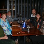
- New Years eve dinner
-
- Hugos party hat
-

- Caroline and Hugo